 |
 |
 |
 |
 |
|
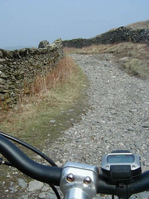
The Start
|
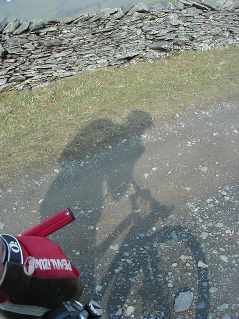
What's that strange grey thing following
me?
|
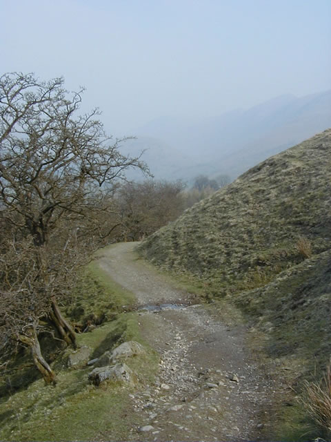
Dubbs Road
|
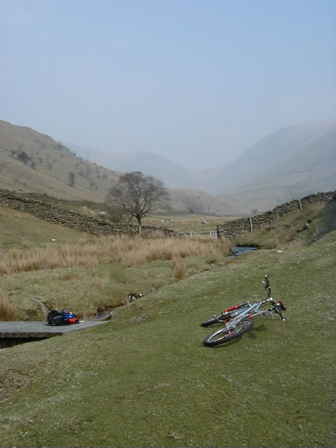
Run down to the campsite
|
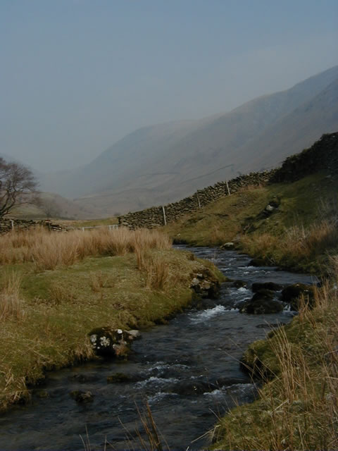
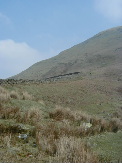
Hagg Gill
|
|
|
|
|
|
|
|
The Start
|
What's that strange grey thing following
me?
|
Dubbs Road
|
Run down to the campsite
|
Hagg Gill
|
 |
|
Hagg Gill
|
 |
|
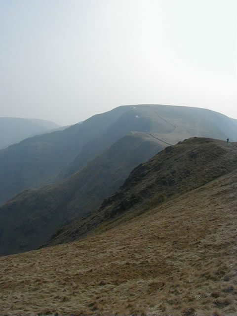
Onwards and Upwards
|
 |
|
Half way up
|
 |
|
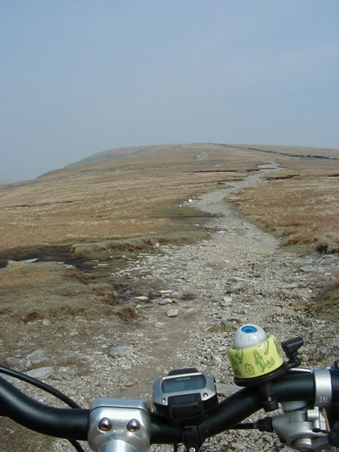
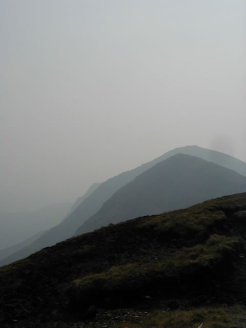
Ill Bell ridge
|
 |
|
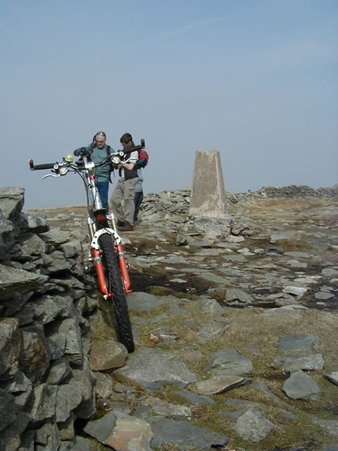
High Street Summit
|
 |
|
The rocky run along High Street
|
 |
|
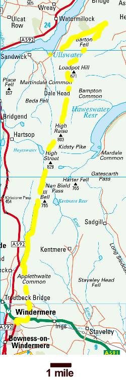
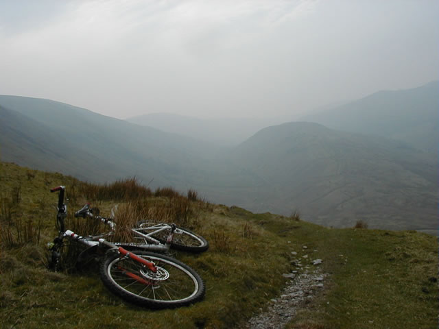
The vague moorland track
|
 |
|
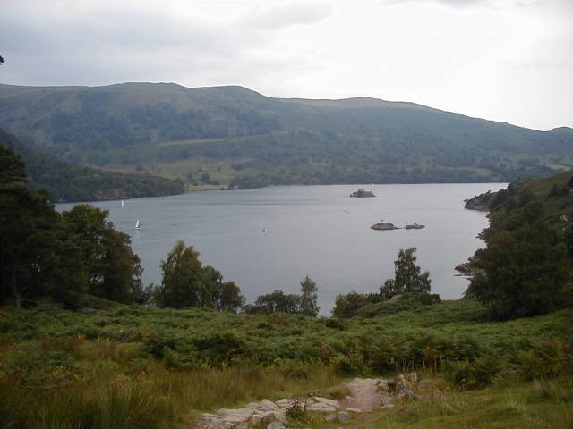
The ferry to Glenridding
|
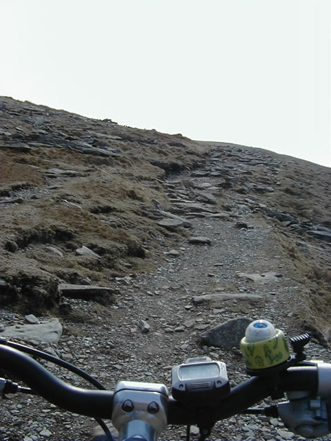
I'd set out twice before to cycle down the High Street but failed. The first time I'd made it to the top but was beaten back by the weather and concerns about being able to find my way in the dense cloud and driving rain. The next time, one look at the weather told me it was not even worth setting out. But today the forecast was good, the sun was shining and the plan was to cycle down the High Street while Sue and the girls went shopping and we could meet up at the end.
So at 10 o'clock in gentle spring sun I turned onto Dubbs Road, a gentle undulating track that ends in Garburn Road and a quick downhill dash through a couple of interesting corners to the start of the High Street.
Perhaps I should explain - High Street is an old Roman road that cuts northwards across the English Lake District in a straight line, casually ignoring the mountains nature had placed in its way in a way that only the Romans, with their penchant for straight roads, would think of doing.. I would be following in the footsteps of the Roman legions as they traveled north 2000 years ago to quell the restless natives in this northern outpost of their empire.
It started easily enough with a fast downhill tree lined run down to a busy campsite followed by 3 miles of gently climbing undulating farm track down the Troutbeck valley. Streams to be forded, puddles to be jumped and the odd bit of rocky climb to warm up on. Then through Hagg Gill, up through the gate and the start of the hard work - 1400ft of climbing straight up the side of Park Fell with not a chance of riding any of it. This is why its called a push bike! At times I had trouble climbing at all and resorted to heaving the bike up a few feet and then hanging on to it while I climbed up after it. Did the Roman legions really march this in full armour?
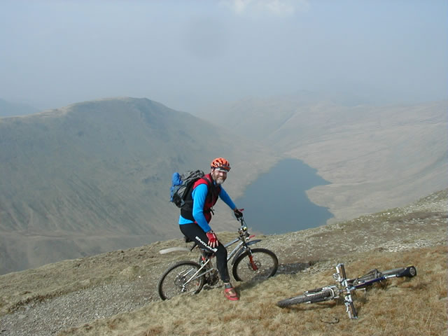
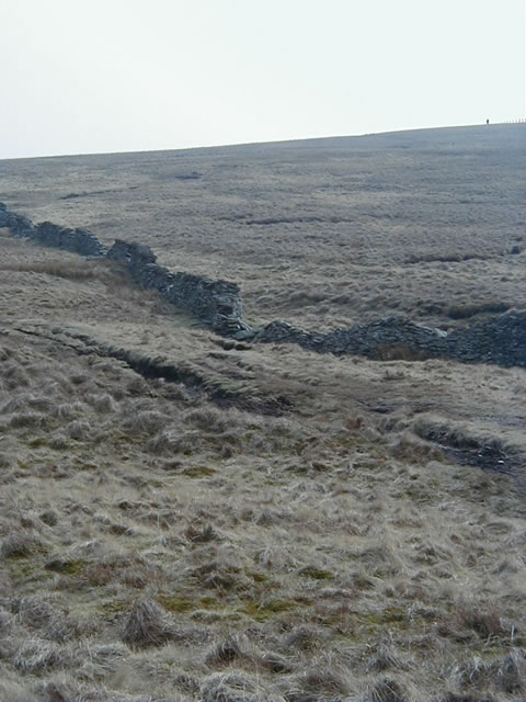
Longer than I care to remember later the hill was crested but still not a time to remount with Gavel Crags to be negotiated. The narrow singletrack, while rocky, was rideable enough but it clings to the edge of a shear 1000ft drop straight down to Kentmere reservoir. I valued life to much to risk a mistake here and pushed the bike with care onto the start of the High Street proper. At first a broad rocky path climbed gently across the hill top slightly east of the summit at 2700ft. In earlier years they used to hold horse races here between the rocky drop offs on both sides but today is was a cosy corner in the shelter of the wall for a lunch break by the trig point. Getting back to the path fully nourished the cliffs on the left side now wanted to grab my attention. The path turned downhill for 3/4mi of exhilarating rocky dash with the adrenalin buzz of a slightly less immediate but rather close for comfort 1000ft drop to Hayeswater to the left. Through the gap in the wall at the Straights of Riggindale where the cliffs crowded in from both sides and then a short rocky climb before turning off onto the moorland for the climb to High Raise and the eight mile mostly downhill run to Ullswater. Past High Raise the track becomes indistinct across the moorland tops of Red Crag and Wether Hill, disappearing every now and again into strength sapping peat bogs that had to be pedalled downhill. On the few uphill peat bogs I walked. It was either that or imitate a paddle steamer digging deep ruts into the peat surface.
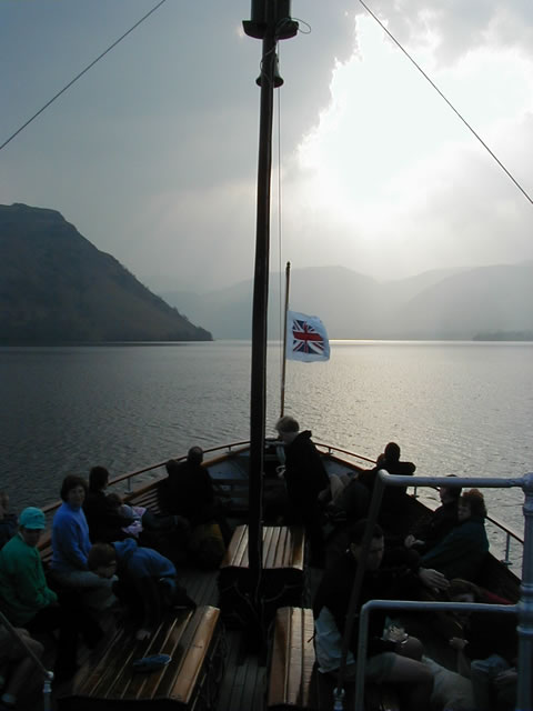
Even with GPS in the sunshine, navigation was not easy with featureless moorland and the faint singletrack that would periodically disappear into a peat bog to reemerge who knew where. Sheep tracks added further confusion and I decided I'd made the right decision on earlier attempts. Climbing up Loadpot Hill the track and tyre marks carried on up past the remains of a stone building but the map said left along a feint sheep track that contoured round the hill. The moorland surface was drier and rockier here as the 6" gully of a singletrack wove its way round the hillside and then dropped into an exhilarating stepped and rutted peat and rock track that ran downhill for 2 miles all the way to the Cockpit stone circle. A quick 170 degree turn and it was downhill again across the flanks of Barton Fell and looking out over the expanse of Ullswater and on down to Howtown for the last ferry across to Glenridding, the family and a big big cappuccino before a change out of muddy clothes in the car park. Just over 7 hours for 25 miles of all off-road, sunshine and big grins all the way!
![]()